# 1st Filter
Do you remember the cadastral parcel number "05430202600946\_\_\_\_\_\_" I mentioned in introduction? Did you find out, where it is meanwhile?
No?
Ok, let's find it out together!
To do this, we will use the following **Filter Expression**:
```xml
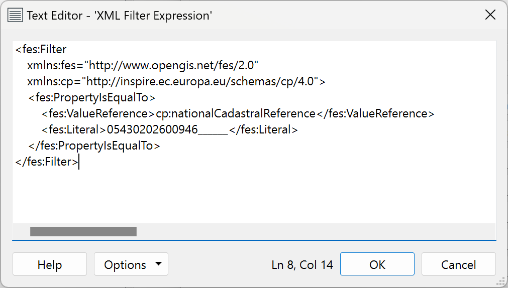
cp:nationalCadastralReference05430202600946______
```
You recognize the key value pair and the operator?
| Key | Value | Operator |
| ----------------------------- | -------------------------- | ---------------------------- |
| cp:nationalCadastralReference | 05430202600946\_\_\_\_\_\_ | PropertyIsEqualTo (i.e. "=") |
Now open a new blank FME Workbench!
Insert a **OGC WFS (Web Feature Service)** Reader.
Open **\[Parameters ...]** and paste the following URL:
```url
https://www.wfs.nrw.de/geobasis/wfs_nw_inspire-flurstuecke_alkis?
```
Select ***CadastralParcel*** as **\[Feature Types]**.
Delete **\[Max Features]** if set.
Now open the **\[XML Filter Expression]** editor **\[...]** and paste the XML from above.
Close the editor with **\[OK]** and the **\[Parameters]** and **\[Add Reader]** windows also with **\[OK]**.
Now **\[Run Just This]** (in Feature Caching mode).
Explore the one feature the WFS returns:
You know where we are?
Ok, that works!
But I'm really sorry to disappoint you!
We have to return to theory again.
## Good to know #2
Do you also use **ArcGIS Desktop**, i.e. **ArcMap** and **ArcCatalog**?
If so, you can do the same in ArcGIS Desktop, if **Interoperability Connections** are installed.
It's because Interop Connections are FME!
---
# Agent Instructions: Querying This Documentation
If you need additional information that is not directly available in this page, you can query the documentation dynamically by asking a question.
Perform an HTTP GET request on the current page URL with the `ask` query parameter:
```
GET https://olivers-expression-lab.gitbook.io/filter-expressions-in-fme/1st-filter.md?ask=
```
The question should be specific, self-contained, and written in natural language.
The response will contain a direct answer to the question and relevant excerpts and sources from the documentation.
Use this mechanism when the answer is not explicitly present in the current page, you need clarification or additional context, or you want to retrieve related documentation sections.